Radar image courtesy of meteoradar.co.uk
spacer
METRIC | IMPERIAL
Updated: 05/06/2023 @ 22:15  
Temperature Current Conditions Forecast / Storm Prediction
Currently Outside: Colder 1.7°C than last hour.

15.9°C

---
High Today
22.7°C
16:02
Low Today
10.9°C
05:50
Yest High
22.2°C
17:12
Yest Low
10.0°C
05:22
Sta* High
21.1°C
2016
Sta* Low
7.2°C
2014
* This Station's Records Since 2011
Station Record High
Dry Dry

Wind from E Wind:  E
4.7

Gusting to:
3.5 km/h
Current Rain Rain:
0.0 mm
Tonight

Fog late
Fog late
Low: 10°
Tuesday

Fog a.m.
Fog a.m.
High: 20°
Tuesday
night
Fog late
Fog late
Low: 10°

Click here for full Forecast
SPC Activity Map
Dew Point Liquid Precipitation Wind Speed Sun/Moon
Current: Increased 0.9°C since last hour. 9.4°C
Last Hour: Increased 0.9°C since last hour. 0.9°C
High 12:09: 13.9°C
Low 19:26: 7.2°C
Record High: 21.7°C on
Aug-13-2020
Record Low: -8.6°C on
Dec-3-2010
Wetbulb: 12.5°C
Leaf Wet:7 0
Today: 0.00 mm
Yesterday: 0.00 mm
Last 7 Days: 0.00 mm
Jun Rain: 0.00 mm
Jun to Date
  Avg:10
0.00 mm
Jun to Date
  Diff from Avg:10
No Change 0.00 mm
Jun Avg: 76.30 mm
Diff from Avg: Under 76.3 mm for the month -76.30 mm
Season:1 369.8 mm
YTD
  Avg:11
0.00 mm
YTD
  Diff from Avg:11
Over 369.8 mm for the year 369.80 mm
Last Rain
Time/Date:
May-22-2023
at 06:39
70 rain days in 2023
0 days in June
13 days since last rain
Current: E  4.7 km/h
1Hr Average: 5.9 km/h
Wind Run: 172.11 kms
Wind Gust
Current: 3.5 km/h km/h
Today: 37.2 km/h 14:00
Month: 37.2 km/h 5-Jun
Year: 97.7 km/h 11-Jan
Record Gust: 109.3 km/h
Nov-9-2018
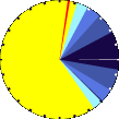
Sunlight:
16 hrs 34 min
of Sunlight Today
graph 69% 31%
Which is
1 min 40 sec Longer
Than Yesterday
 
Waning Gibbous, 17 days, 5 hours, 26 minutes in cycle
96%
Illuminated
Humidity Barometer
Current: Increased 10% since last hour. 65%
Last Hour: Increased 10% since last hour. +10%
High 05:48: 80%
Low 17:17: 40%
Record High: 100%
Oct-29-2010
Record Low: 18%
Jun-28-2018
Current: Rising 0.3  hPa/hr 1023.4 hPa
Last Hour: Steady
High 00:33: 1024.9 hPa
Low 18:23: 1022.5 hPa
Record High: 1049.0 hPa
Jan-20-2020
Record Low: 955.5 hPa
Feb-5-2014
Heating Degree Days Snow3 Wind Chill
Today: 3.2
Jun: 12.1
2023 to Date: 1257.8
Cooling Degree Days
2023 to Date: 0.0
Today: 0.00 cm
Yesterday: 0.00 cm
Jun Snow: No Change 0.00 cm
Jun Avg: 0.00 cm
Diff from Avg: 0.00 cm
Season Total:2 0.00 cm
Snow Depth: 0.00 cm
0 snow days in June
0 snow days this season.2
First Snow of Season:
--
Average 1st Snow:
Current: 15.9°C
Low 05:46: 10.8°C
Yesterday: 10.0°C
Record: -10.2°C
Dec-23-2010
UV Summary/Forecast Solar Summary
Jun-05

6.0
Jun-06

5.9
Jun-07

6.0
Sunrise is at: 05:10
Solar Noon: 13:27
Sunset is at: 21:44
Almanac Irrigation Index5 Station All Time Records Cloud Level
Current: Evening
YTD Avg Temp: 9.6°C
Sunrise: 05:10
Sunset: 21:44
Moonrise: 00:10
Moonset: 05:27
Full Moon: Jun-04-2023
New Moon: 04:38 UTC
Jun-18-2023
HIGHS: LOWS:
30.5°C
Aug-14-2022
-7.7°C
Dec-3-2010
Daytime Records
  27.7°C
Aug-12-2022
  -3.8°C
Nov-28-2010
Nitetime Records
  22.4°C
Jun-29-2018
  -4.8°C
Nov-29-2010
ICN:1 | S3C2:1 | Ajax 3.xx
ISS:Ok | CON:4.1 | RCP:98%
1 Rain season: Jan 1st to Dec 31st.   2 Snow season November 1st to March 31th.   3 Snow manually measured usually around 7AM and 7PM.   7 Leaf Wetness is surface moisture on foliage. 0 being totally dry and 15 being totally saturated.   10 Historical average only to day 5 of just the month of June for this station since 2011.   11 Historical average rain this season to day 5 of June for this station since 2011.
 WXSIM Weather Forecast  -   Outlook Tonight & Tuesday
Tonight

Fog late
Fog late
Low: 10°
WXSIM forecast: Clear. Patchy light fog after midnight. Low 10°. Wind east-southeast around 10 kph, gusting to 31 kph, in the evening, becoming northeast after midnight.
Tuesday

Fog a.m.
Fog a.m.
High: 20°
WXSIM forecast: Sunny. Patchy light fog in the morning. High 20°. UV index up to 8. Wind northeast around 13 kph, gusting to 32 kph, in the morning, becoming 19 kph, gusting to 34 kph, in the afternoon.
 WXSIM Short Term Weather Forecast
Tuesday
night
Fog late
Fog late
Low: 10°
Wednesday

Fog a.m.
Fog a.m.
High: 20°
Wednesday
night
Mostly Cloudy
Mostly Cloudy
Low: 13°
Thursday

Mostly Cloudy
Mostly Cloudy
High: 22°
Thursday
night
Mostly Cloudy
Mostly Cloudy
Low: 13°
Friday

Mostly Cloudy
Mostly Cloudy
High: 21°
Friday
night
Chance rain
Chance rain
Low: 12°
Animated icons courtesy of www.meteotreviglio.com
Precipitation average-to-date script courtesy of Murry Conarroe
Version 6.90 - 30-Oct-2013 - Script Mods by: BurnsvilleWeatherLIVE.com
free counters
Free counters
© 2023, Waterford City Weather | Weather-Display (10.37S-(b131)) | Valid XHTML 1.0 | Valid CSS

Never base important decisions on this or any weather information obtained from the Internet.
MetOffice Weather Center PWS WATERF01